Get Hands-On with US History and Geography Using Pin-It Maps!
When you read, are you able to picture the setting and characters in your head? I totally do that. As I’m reading, I’m watching the scenes play out in my head. Sometimes the details get a little fuzzy, though. If I’m reading a book with a picture of the characters on the front, I’ll often flip to the front cover to get the image fresh in my mind before I continue reading.
I thought maybe I was crazy, but I asked Megan, and she said she does that same thing – maybe not flipping to the cover to see the picture. She acted like that was a little weird. But, definitely watching the sometimes fuzzy scene play out in her mind.
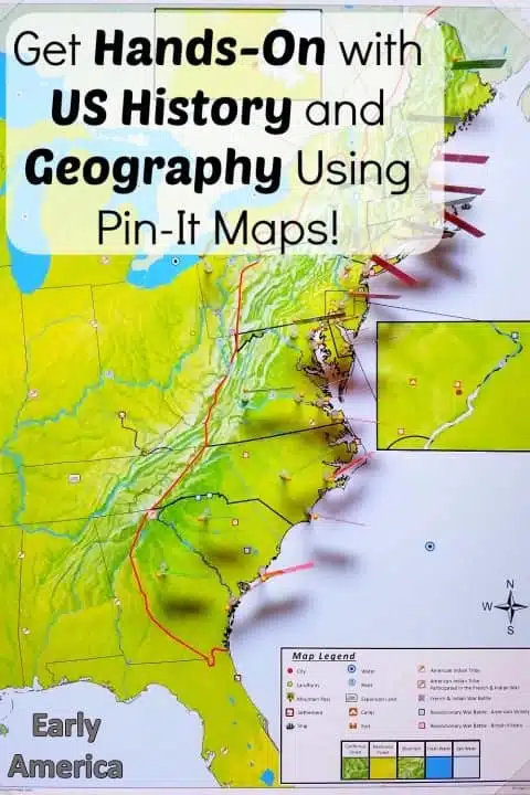
While we might disagree on the front cover thing, we both agreed that having some sort of visual helps us to have a much clearer understanding of what’s going on – and that’s one big reason why we love Pin-It Maps. Being able to look at a map and see how the places relate to each other makes the events we’re reading about make so much more sense.
Megan really enjoyed using Pin-It Maps when she studied world geography a couple of years ago – I mean, really, really enjoyed it because she hated the boring, difficult-to-read, black-and-white outline maps in her textbook. Being able to pin key places and features on the gorgeous, hand-shaded Pin-It Maps helped her to more accurately visualize the places she was studying.
USA and US History Maps from Pin-It Maps
Now the folks at Pin-It Maps have added a fantastic set of USA and US history maps to their collection. If you’re studying anything to do with United States geography or its history, you’ll want to check out these maps!
The new set includes:
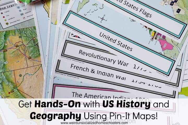
- (3) 18 x 24″ Pin Maps – The United States, US History 1800s, and Early America
- (11) 12 x 18″ Control Maps featuring facts such as American Indians, The 13 Colonies, Revolutionary War, French and Indian War, Westward Expansion, the Civil War, and more
- 557 flag labels and state/ historical flags
- Everything you need to assemble and use the maps, including two 18 x 24 x .5″ foam sheets with plastic corners; plastic flagpoles and bases; and even the tape to assemble the flags
The only thing you’ll need that is not included is a set of size 28 1-3/4 inch straight pins because they pose a safety risk for shipping, but they’re readily available at Amazon, hobby stores, and usually in the craft/sewing section of most department stores.
How to Use Pin-It Maps
These gorgeous, detailed maps are versatile enough to make an excellent addition to nearly any US history and/or geography curriculum or unit study. Farmhouse Schoolhouse shared some fantastic ideas for creating a unit study based on the US map bundle.
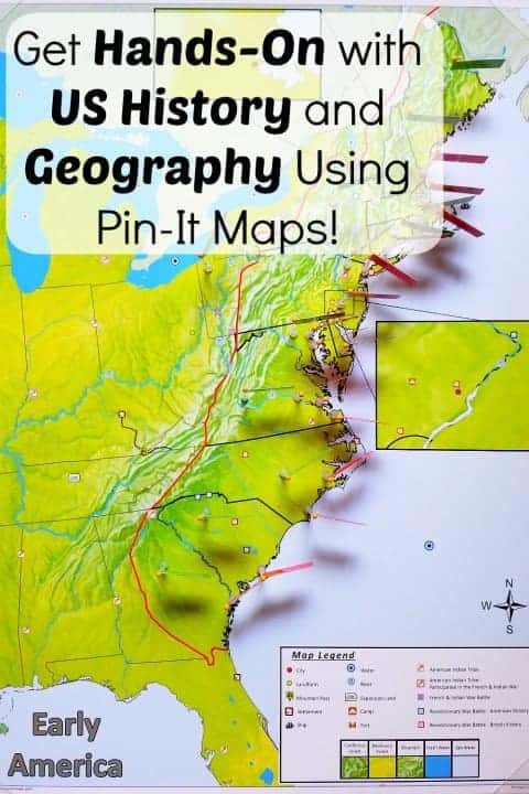
We recently decided to bridge Megan’s Titanic study and her World War I/World War II study with a brief overview recap of American history. We’re using the History Channel’s The Story of Us along with the USA and US history map bundle. After watching the episode on the early settlements, Megan pinned the 13 colonies and major settlements.
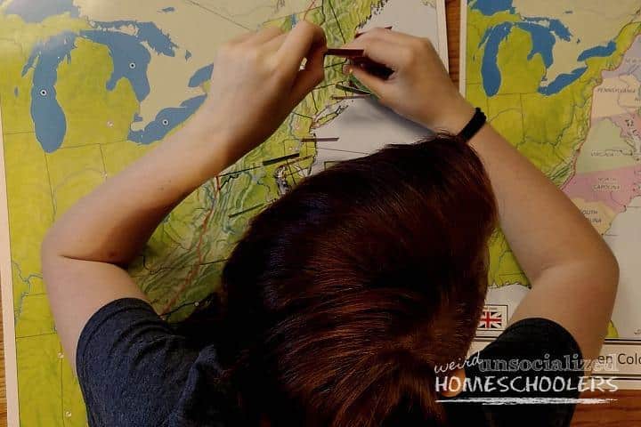
As she goes through, she’ll be able to pin Native American tribes, westward expansion, Revolutionary and Civil War battles and more – there are control maps for each of those!
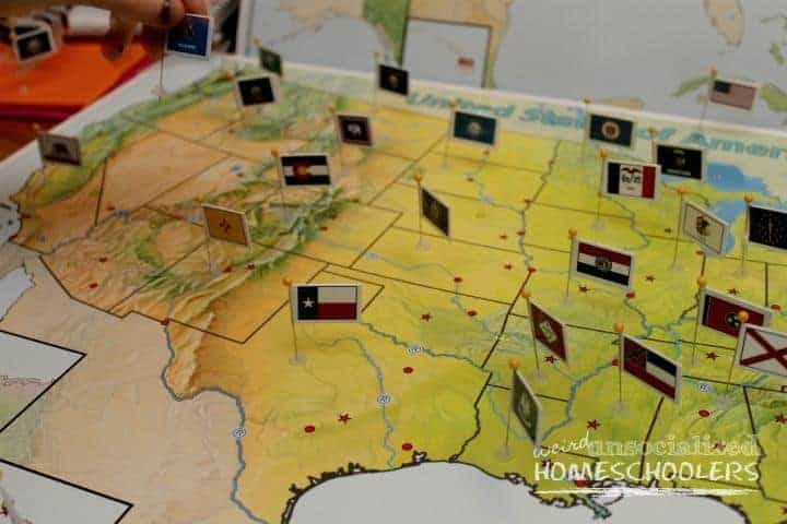
There are also flag pins for all 50 states, which will make a perfect addition to our 50 states study. These pins have provided (and will continue to provide) excellent practice for matching each state with its flag and correctly locating each state on the unlabeled map.
Plus, each flag pin has the two state abbreviation on the back which is great practice for kids and adults alike. (Please tell me I’m not the only one who has to think for a couple of seconds about the M states.)
There are a couple of ways you can go about assembling the flags. Option 1 is to pull out all your supplies and assemble them while binge-watching your favorite TV show. It’s a good excuse if you need one. {grin}
Option 2 is just to assemble each set as you need them. That’s what we’ve been doing. Megan has assembled all of our flag pins because it’s something she can easily do while FaceTiming her friends. See? The good excuse works there, too. “I am doing school, Mom. I’m assembling flag pins.”
Once assembled, an IRIS photo storage case is an excellent option for storing the flags. You can order preprinted storage container labels, which fit perfectly on the photo storage containers and are color-coded to match the flags, making it easy to quickly find the ones you’re looking for.
We love Pin-It Maps for studying U.S. history and geography and we think you will, too!
Kris Bales is a newly-retired homeschool mom and the quirky, Christ-following, painfully honest founder (and former owner) of Weird, Unsocialized Homeschoolers. She has a pretty serious addiction to sweet tea and Words with Friends. Kris and her husband of over 30 years are parents to three amazing homeschool grads. They share their home with three dogs, two cats, a ball python, a bearded dragon, and seven birds.


We love to locate areas we’re studying in our unit studies on a map in the dining room, but after putting so many marks on the map, it can be hard to tell what’s what anymore. Thanks for reviewing this. I will definitely be looking into it when I go curriculum and resource hunting after Christmas.
Thanks for the review. I’m going to be checking out this hands-on resource for my hands-on learners.
We love their world maps – these would be a hit at my house!